View Larger Map
Date: 080515-Thursday
Starting Point: Iksan, South Korea
Riders: Greg - Hyosung 650 GTR, Older Greg - Honda 750 Magna
Terrain: Highway and secondary
Curves: Nice mix of constant sharp and soft curves
Grade: Mostly flat
Difficulty: 7/10
GPS Trip Data:
Summary Data
Total Time (h:m:s) 3:41:48 1:30 pace
Moving Time (h:m:s) 1:59:31 0:48 pace
Distance (km) 146.67
Moving Speed (kph) 73.6 avg. 199.2 max.
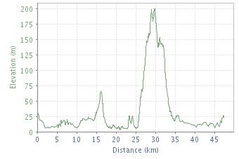
Elevation Gain (m) +535 / -553
Temperature (°C) 16°C avg. 16°C high
Distance Data Total (km) % of Total
Distance 146.67 100
Ascent 6.73 4.6
Descent 6.05 4.1
Flat 133.88 91.3
Description:
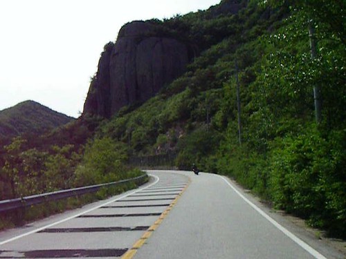
This time around I followed Greg due South over some of the most brilliant terrain I've seen to date in Korea. You have to pay your dues on bland, open stretch of highway for the first 40km or so, but the payback is ten fold once you're finally able to veer-off into a mountainous valley. The country road snakes its way through farmers' fields, along side a meandering river, and every now and then steep mountains expose their sheer granite faces from behind the lush green foliage.
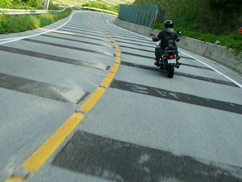
There is hardly a meter of road which follows a straight line. The curves vary from gentile to tight while elevation remains fairly consistent. Unfortunately, slightly raised black stripes of asphalt stretch across every corner however, even at 120km an hour, they are barely noticeable. If anyone knows what purpose these stripes serve I'd be eager to know.
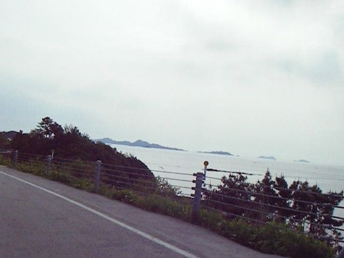
Eventually the road opens up and passes through a small town but this is no where near the end of the journey. Only 5km away lies another stretch of twisty highway, this time overlooking the West Sea and a chain of Korean islands just off the coast. In addition to curves, there are now decent rises and dips along the way. We chose to turn around at the port in Chonggam, backtracked a ways, and hit up a new beach for a beer and some Ramion noodles. Greg and I both agreed that the return route along the costal section somehow felt far better in the corners.
After a short rest on the beach Greg and I choose a new path to return to Iksan on. The fist section of highway contrasted nicely with the previous sections, now we could open our bikes up to around 140 and enjoy some big, wide bends. Alas, all good things must come to an en, we joined up with the bland, open highway we began on and weaved our way through the traffic back into Iksan.
Motorbike, Rides, South Korea, Routes, Paths, Review, Google Earth, KML, KMZ, Greg, Hyosung, 650cc, GTR, Honda, 750cc, Magna
--------------- www.comatosed.ca ---------------